...
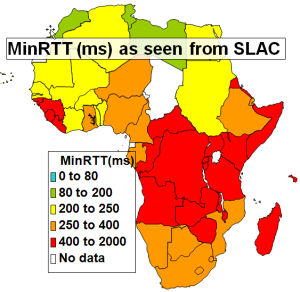
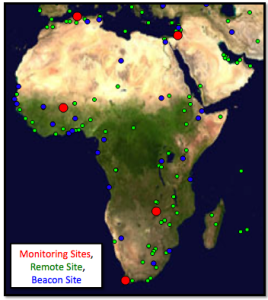
<ac:structured-macro ac:name="unmigrated-wiki-markup" ac:schema-version="1" ac:macro-id="a6c589e07b38d920-b0eff0bf-46094164-ab1eb28e-fd250a3643871bffa7910a48"><ac:plain-text-body><![CDATA[ | MinRTT from SLAC - Aug. 2009 [[xls | ^map-africa-minrtt-aug2009.xls]] | PingER Coverage in Africa | ]]></ac:plain-text-body></ac:structured-macro> |
|---|---|---|---|---|
| |
...
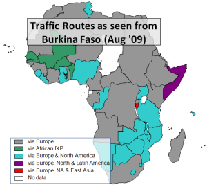
East Africa contains 300M people, yet less than 3% are Internet users (see Internet usage for Africa). In the past the area has had poor Internet connectivity with mainly geostationary satellite connections to the outside world. In addition most of the traffic between countries made use of expensive international links via Europe and the U.S. rather than more direct connections. There are active movements to create National Research and Education Networks (NRENs) in the area, see for example "Sub-Saharan Africa: An update" by Boubaker Barry. This, together with direct connections between countries will enable more direct peering. These NRENs in turn are peering with the GEANT network in Europe through the Ubuntunet Alliance. The map below on the left shows the state of African NRENs in 2008. On its right In the middle can be seen how the routes traffic from South Africa takes to get to other African Countries in September 20082005. On the right can be the routes from Burkina Faso to other Africa countries measured in August 2009.
<ac:structured-macro ac:name="unmigrated-wiki-markup" ac:schema-version="1" ac:macro-id="1a5d671c6ad96581-22b3b3db-41e04854-8736bdcc-e5a04eb4f1b9d7fa952140ca"><ac:plain-text-body><![CDATA[ | NRENs in Africa | Routing from South Africa to African Countries (Sep '05) | Routing from Burkina Faso to African Countries (Aug '09) [[xls | ^routing-africa.xlsx]] | ]]></ac:plain-text-body></ac:structured-macro> |
|---|---|---|---|---|---|
| | |

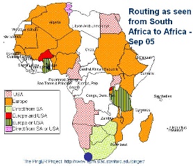
It can be seen that NRENs are being created and that in September 2008 most traffic from South Africa to the rest of Africa took costly international links. More details on the routes to African countries from several measurement points around the world measured in Spring 2009 can be seen in a spreadsheet of African routing and inferences.
In September 2005 it can be seen that South Africa had direct connections to only Botswana and Zimbabwe. Connections to other Africanm countries all went via European or North American countries or both.
Connections from Burkina Faso in August 2009 were direct to Senegal, Mali, and Benin. Most other countries are reached by intercontintal connections via Europe, followed by many taht go via Europe and N. America. Somalia is reached via Europe, N. and S. America, and Burundi via Europe, N. America and E. Asia.
Initial Results
One would expect with the use of a terrestial fibre rather than a geo-stationary satellite that the minimum RTT woud be reduced from >=400ms to 200-300ms as seen from the US. Also the reduced congestion enabled by the higher speed links should make the average RTT more stable and reduce the packet loss. Below are shown the average RTTs and losses from SLAC on the West Coast of the US to various hosts on the East Coast of Africa. These are all measured using the PingER project's data.
...