...
Note that in the following comparison I used only time bins in common between the two sets of files (i.e., with the same START and STOP time). Since we changed the way of handling gaps and other things (like change in mode or configuration), there are a small number of discrepancies in the binning scheme between the two files.
Whole FT2
For this first set of results, I compared each pair of FT2 files from the start of the first bin to the end of the last one. Thus, differences due to Reason 1 above are evident.
Quantity | Columns in the FT2 file | Histograms | Comment |
|---|---|---|---|
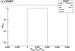
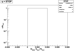
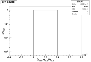
Bin start and stop | START, STOP | | No differences, by definition. |
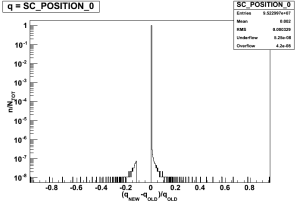
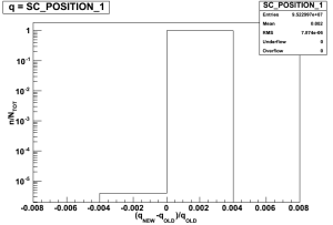
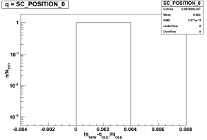
Spacecraft position in ECI coordiantes (x,y,z) | SC_POSITION array | | The differences in a very small number of bins are most probably due to Reason 1 above. |
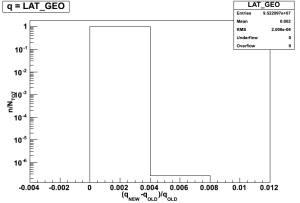
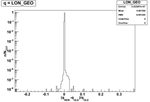
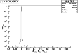
Ground point latitude and longitude | LAT_GEO, LON_GEO | | Reason 1. |
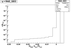
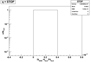
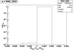
Spacecraft altitude | RAD_GEO | | Reason 1. |
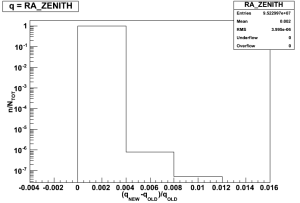
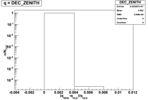
Zenith direction | RA_ZENITH, DEC_ZENITH | |
|
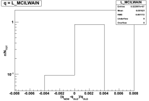
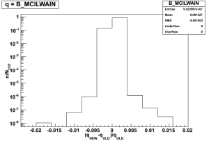
McIlwain coordinates | L_MCILWAIN, B_MCILWAIN | |
|
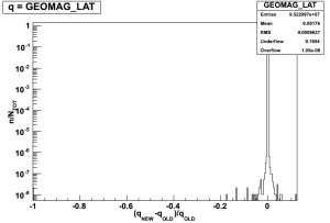
Geomagnetic latitude | GEOMAG_LAT | | 16 percent of the time bins are in the underflow bin of the histogram. This is due to a known issue: on Feb. 2, 2010 we changed the quantity from unsigned to signed. Thus, all old FT2 files produced before that date have a always-positive GEOMAG_LAT, while the reprocessed ones have it signed from the beginning of the mission. |
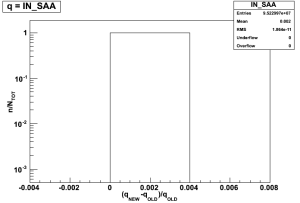
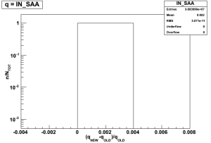
South Atlantic Anomaly flag | IN_SAA | |
|
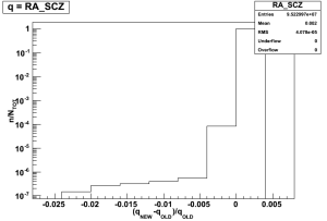
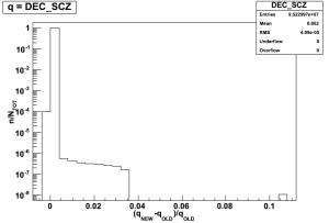
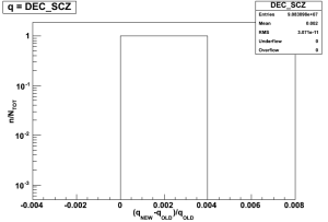
Z-axis direction | RA_SCZ, DEC_SCZ | | Reason 1. |
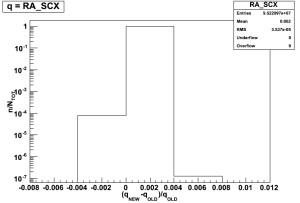
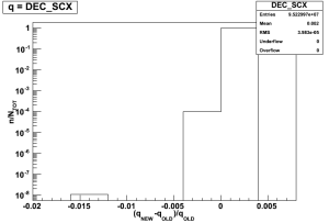
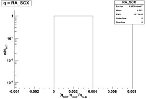
X-axis direction | RA_SCX, DEC_SCX | | Reason 1. |
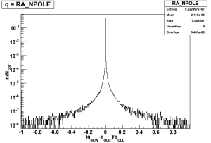
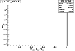
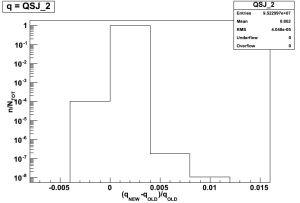
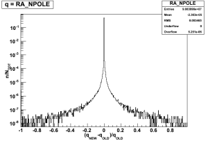
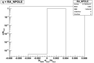
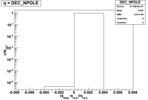
Orbital Pole direction | RA_NPOLE, DEC_NPOLE | | Here there are considerable differences, because the new code compute the coordinates of the Orbital Pole in a different way respect to the old one. If vi is the position vector for the i-th bin in the FT2 file, the old code computed the orbital pole vector for the i-th bin as the cross product between vi-1 and vi, while the new code uses the product vi cross vi+1. Thus basically I should compare each i-th entry in the new set with the (i+1)th entry in the old one, to obtain the same results. I don't understand why the differences are basically only in the RA, thoughdid this test, and everything is ok, see below. |
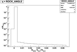
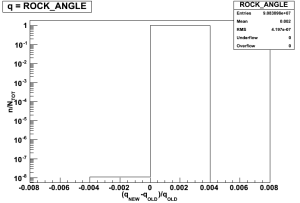
Rocking angle | ROCK_ANGLE | | Reason 1. |
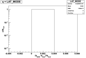
LAT GNC mode | LAT_MODE | |
|
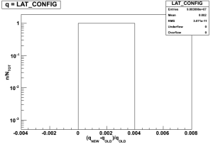
LAT Configuration | LAT_CONFIG | |
|
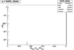
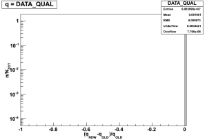
Data quality flag | DATA_QUAL | | Need to check why there are these differences in a couple of runs. I suspect those are BAD runs, or runs with the new values for the DQM flag. |
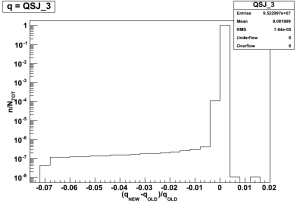
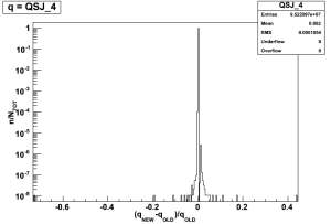
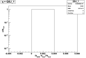
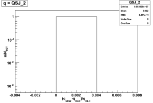
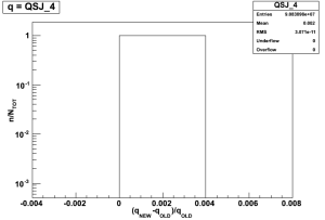
Attitude quaternion | QSJ_1,QSJ_2,QSJ_3,QSJ_4 | | Reason 1. |
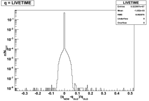
Live time | LIVETIME | | Differences are due to the bug already found in the old FT2 code. See below. |


Sub-interval
Here I repeated the same exercise, but excluding the first and the last 50 seconds from each file, to avoid the "border issue". Indeed, most of the differences are now gone:
Quantity | Columns in the FT2 file | Histograms | Comment |
|---|---|---|---|
Bin start and stop | START, STOP | | No differences, by definition. |
Spacecraft position in ECI coordiantes (x,y,z) | SC_POSITION array | |
|
Ground point latitude and longitude | LAT_GEO, LON_GEO | |
|
Spacecraft altitude | RAD_GEO | |
|
Zenith direction | RA_ZENITH, DEC_ZENITH | |
|
McIlwain coordinates | L_MCILWAIN, B_MCILWAIN | |
|
Geomagnetic latitude | GEOMAG_LAT | | 16 percent of the time bins are in the underflow bin of the histogram. This is due to a known issue: on Feb. 2, 2010 we changed the quantity from unsigned to signed. Thus, all old FT2 files produced before that date have a always-positive GEOMAG_LAT, while the reprocessed ones have it signed from the beginning of the mission. |
South Atlantic Anomaly flag | IN_SAA | |
|
Z-axis direction | RA_SCZ, DEC_SCZ | |
|
X-axis direction | RA_SCX, DEC_SCX | |
|
Orbital Pole direction | RA_NPOLE, DEC_NPOLE | | Here there are considerable differences, because the new code compute the coordinates of the Orbital Pole in a different way respect to the old one. If vi is the position vector for the i-th bin in the FT2 file, the old code computed the orbital pole vector for the i-th bin as the cross product between vi-1 and vi, while the new code uses the product vi cross vi+1. Thus basically I should compare each i-th entry in the new set with the (i+1)th entry in the old one, to obtain the same results. I did this test, and everything is ok, see below. |
Rocking angle | ROCK_ANGLE | |
|
LAT GNC mode | LAT_MODE | |
|
LAT Configuration | LAT_CONFIG | |
|
Data quality flag | DATA_QUAL | | Need to check why there are these differences in a couple of runs. I suspect those are BAD runs, or runs with the new values for the DQM flag. |
Attitude quaternion | QSJ_1,QSJ_2,QSJ_3,QSJ_4 | |
|
Live time | LIVETIME | | Differences are due to the bug already found in the old FT2 code. See below. |


There are still some differences in some quantities related to the EarthCoordinate class of the astro package. By looking at the time histories, all the differences are before a certain date, thus they are almost certainly related to a bug-fix in the astro package. (to be confirmed)
Orbital Pole
I repeated the comparison between the RA_NPOLE and DEC_NPOLE quantities, but comparing a given i-th bin of the old version of the FT2 files with the i-th-1 bin in the new FT2 file, to solve the discrepancy in the computation method. As expected, the differences vanish:
Livetime
As already found in my former test (see the mother page), the old code had a bug in the livetime computation. Here I show the difference in livetime between the two codes, as function of time, thus on the y-axis there is the usual fractional difference, while on the x-axis there is the MET time (in seconds):
(text continue below the gallery, click on an image to enlarge it)
...