| Table of Contents |
|---|
Introduction
Visual Traceroute is a new feature that can be accessed by calling reflector.cgi with function=vtrace. Currently it can provide visual traceroute from 5 PingER monitorsfrom 29 landmarks (2 in USA and 1 per each of 27 countries). Some of these are listed below, for a complete list check the from dropdown:
- www-wanmon.slac.stanford.edu, SLAC National Accelerator Lab, near San Francisco, California, USA
- pinger.cern.ch, CERN, Geneva Switzerland
- maggie1.seecs.edu.pk, National University of Science and Technology, Islamabad, Pakistan
- mel-a-ext1.aarnet.net.au, Australia's Academic and Research Network, Melbourne, Australia
- pinger.fsksmfsktm.um.utmedu.my, University of Malaya, Kuala Lumpur, Malaysia
lblnet-test.lbl.gov(131.243.24.12), LBL, Berkeley, California, USA
It works by first finding the traceroute to the target using the traceroute.pl installed at the monitoring landmark node and then geolocating each on of the intermediate hops hop routers using TULIP. It can be accessed from from http://tulip.slac.stanford.edu or here.
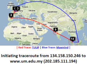
We use TULIP's dynamic ping-based geolocation as compared to say database methods such as used by MaxMind derived tools like GeoIPTools, since often router locations in the database tend to be given as at the corporate HQ that owns the routers (e.g. ESnet routers may supposedly be located in Berkeley).
Performance
Normally it would take about 10 mins to perform a complete visual traceroute but we have incorporate incorporated caching to speed up the process. Currently about 2000 As the router locations are found they are automatically cached in /nfs/slac/g/net/pinger/tulip/cachetr/cache.txt
Whenever the location of a new router is found it is automatically add to the cache, hence the cache is updated dynamically. If the location of all the routers in the requested vtrace are cached then it takes only about 10 secs to give the output.
Working Specifics
A subset of the Maxmind city database is used to find the nearest city to each router, only cities with population greater than 100,000 are considered.
- The database used is /nfs/slac/g/net/pinger/tulip/citidb.txt
Both PingER and PerfSONAR landmarks can be used as the traceroute source
- List of possible PingER landmarks is /nfs/slac/g/net/pinger/tulip/pinger_vtrace.txt
- List of possible PerfSONAR landmarks is /nfs/slac/g/net/pinger/tulip/psonar_vtrace.txt
- or simply see http://www-wanmon.slac.stanford.edu/cgi-wrap/reflector.cgi?PE=set&PSE=set&function=landmarks
Visual Traceroute can be called directly from URL. The format is:
- http://www-wanmon.slac.stanford.edu/cgi-bin/reflector.cgi?function=vtrace&from=Landmark_HostName&target=target_IP_or_HostName
- for Landmark_HostName see http://www-wanmon.slac.stanford.edu/cgi-wrap/reflector.cgi?function=landmarks in some cases the HostName is the same as IP
The From landmarks drop down list is populated from /nfs/slac/g/net/pinger/tulip/from.txt .This list if checked and updated daily from crontab using vtracefromchk.pl
Certain routers can not be geolocated because they respond to only a few pings or don't respond to them at all. A script vtrace0chk.pl tries to geolocate such routers in the cache and updates the cache accordingly each night.
Both vtracefromchk.pl and vtrace0chk.pl are placed in /afs/slac/package/pinger/tulip/ and executed via trscrontab in pinger.slac.stanford.edu for user pinger.
Design
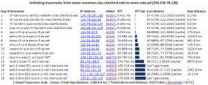
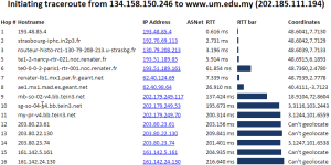
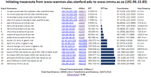
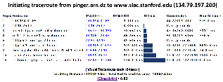
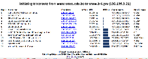
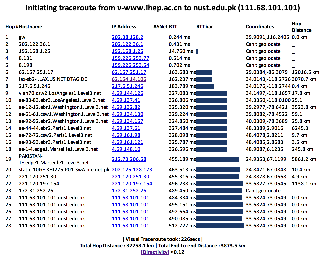
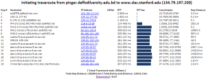
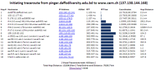
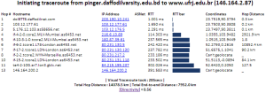
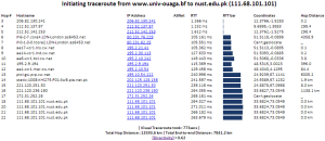
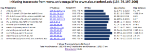
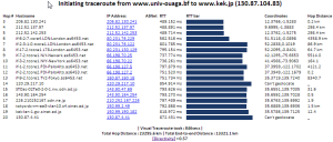
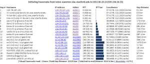
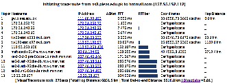
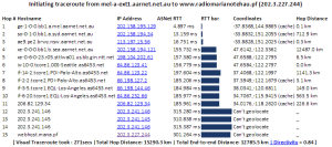
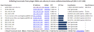
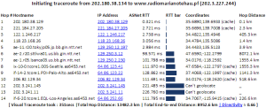
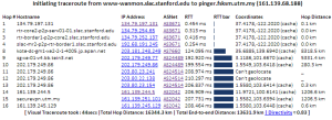
The tabular traceroute is shown together with the Autonomous System Number (ASN), if known, the router's location coordinates and distance between hops. Clicking on the IP address will take you to the TULIP geolocation utility. Clicking on the ASN will provide information on the ASN.
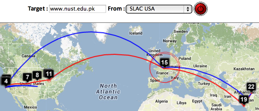
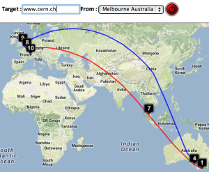
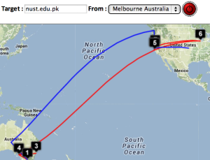
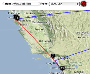
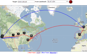
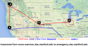
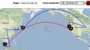
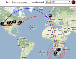
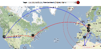
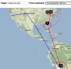
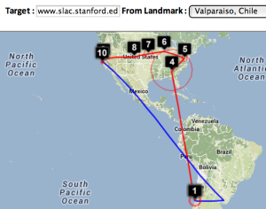
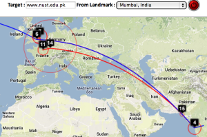
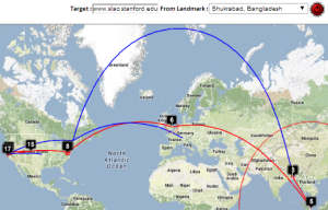
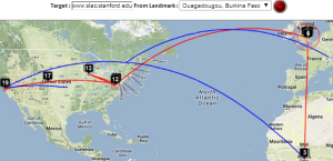
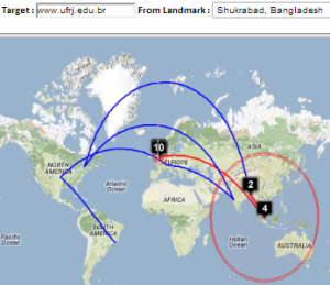
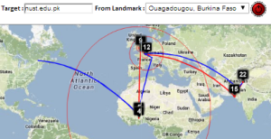
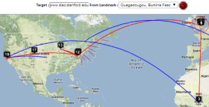
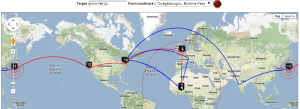
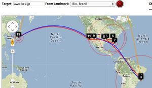
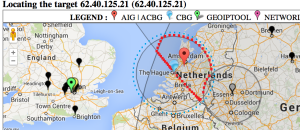
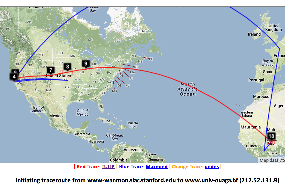
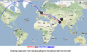
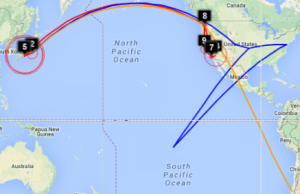
Two traceroute paths of traceroute are shown on google maps, one the google map. One (shown in red) is drawn using TULIP and the other (shown in blue) is drawn using MaxMind (an IP host location database). The hops are shown as appropriate numbered markers, the error in the estimated location is shown as a red circle. See the figure below:
This figure shows the traceroute from SLAC to NUST Pakistan. http://www-wanmon.slac.stanford.
...
edu/cgi-wrap/reflector.cgi?function=vtrace&target=nust.edu.pk
Comparisons between MaxMind and TULIP
This presentation was sent to Harvey.
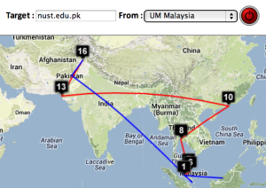
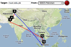
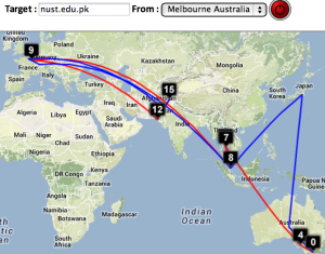
| University of Malaya, Kuala Lumpur to NUST Islamabad | NUST Islamabad to University of Malaya | CERN to NUST | Melbourne to NUST | Melbourne to CERN | Melbourne to SLAC | CERN to UCSD |
|---|---|---|---|---|---|---|
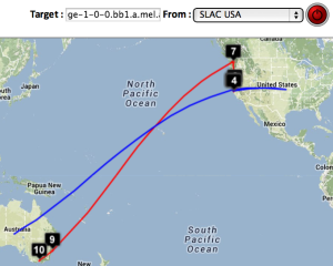
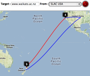
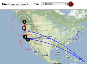
| SLAC to CERN | SLAC to ICTP Trieste | SLAC to NUST | SLAC to UCSD | SLAC to Melbourne | SLAC to Waikato New Zealand | SLAC to U Oregon |
|---|---|---|---|---|---|---|
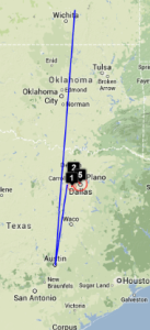
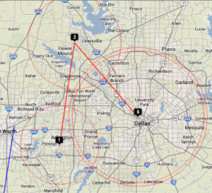
| SLAC to Andora | SLAC to Malaysia | Dallas to Dallas | Dallas to Dallas detail | SLAC to emergency.slac.stanford.edu | Detail on emergency | |
|---|---|---|---|---|---|---|
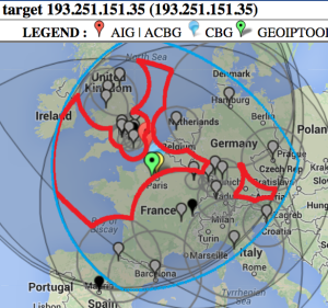
| . | GeoIPtools ends in Brazil. | |||||
| Strasbourg to UM | LBL (Berkeley CA) to UM | SLAC to Cape Town | Algiers to SLAC | Bolivia to BNL New York | Valparaiso Chile to SLAC | Mumbai to NUST, Islamabad |
|---|---|---|---|---|---|---|
| Beijing to NUST | Bangladesh to SLAC | Bangladesh to CERN | Bangladesh to Rio de Janeiro | Burkina Faso to NUST | Burkina Faso to SLAC | Burkina Faso to KEK Tokyo |
|---|---|---|---|---|---|---|
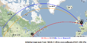
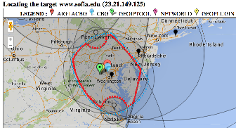
| Taiwan to NUST | England to Washington DC | TULIP location of Sofia University | Rio to Tokyo |
|---|---|---|---|
The England to Washington DC is interesting since VTrace, Maxmind and undns (orange line) give very different results for the target. Despite Sofia University advertising itself as being in Palo Alto the web server is actually near Washington DC. Also the route does not go from London to Paris as indicated by Maxmind.
Complementarity of VTrace and MaxMind
SLAC to Portugal
| SLAC to Braga Portugal overview | SLAC to Braga, W. Coast US | SLAC to Braga via Netherlands and UK | SLAC to Braga, Portugal detail | Traceroute | TULIP geolocation of Braga |
|---|---|---|---|---|---|
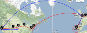
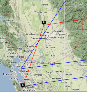
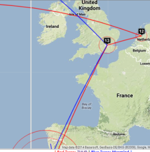
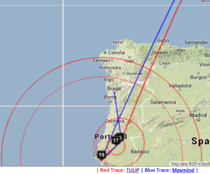
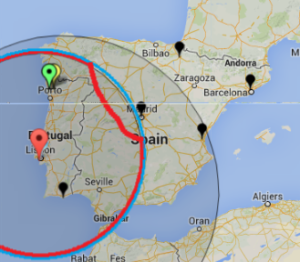
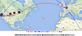
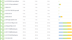
By providing both VTrace (red) and Maxmind (blue) routes, the results can be complementary in ascertaining the correct route. This is illustrated in the plots below from SLAC to a host in Braga Portugal (193.136.19.13). The left hand map shows how VTrace accurately traces the route across the US, while Maxmind jumps from SLAC to the middle of the US, back to Berkeley and thence to Europe. This is shown in more detail in the W. Coast US map. Moving futher right, Vtrace shows the route through the Netherlands and the UK, while Maxmind misses the Netherlands altogether. The Portugal detail indicates that Maxmind is more accurate in showing the final route to Braga. However, note that the Vtrace accuracy circles indicate the considerable uncertainty in the location of the last hop, hence improving one's confidence. The traceroute figure which indicates that hops 12 and 13 are likely to be in the Netherlands and the UK given their naming conventions (note the top level domains .nl and .uk in the names). The TULIP plot shows how the paucity of nearby landmarks (black market balloons) results in the poor geolocation of the Braga site.
Cape Town to Tokyo
| Cape Town to Tokyo | Amsterdam hop 9 seen by TULIP |
|---|---|
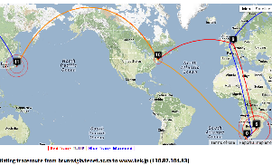
Maxmind catches hop (8) in Europe (but gets hops 8 and 9 in London rather than Amsterdam) that VTRace (hop 8 does not respond to pings) misses and undns (orange line) misses both hops 8 and 9. VTRace catches the Johannesburg hop (4), and Pretoria hops (5) that undns and Maxmind miss. VTRace and undns catch the New York hop (10) that Maxmind misses.
SLAC to Burkina Faso
| SLAC to Burkina Faso |
|---|
Maxmind gets the location of the hops in France, but does not do well in the US.
Pakistan to Washington State
| Pakistan to Microsoft WA |
|---|
For the Pakistan to hotmail.com (Microsoft WA) undns gets off track and goes to Australia. VTrace correctly gets hop 6 as being in Karachi (while Maxmind puts it in the middle of Pakistan), however VTrace loses track after getting to Frankfurt Germany (since hops 9-13 do not respond to pings), while Maxmind gets the end destination as being Microsoft's home of Redmond Washington.
SLAC to Sudan
| SLAC to Sudan | Location of 16th hop |
|---|---|
VTRace gets the route across the US and to France, but not the last hops to Sudan. DeoIPTools gets Sudan as the final destination.
Melbourne to French Polynesia
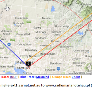
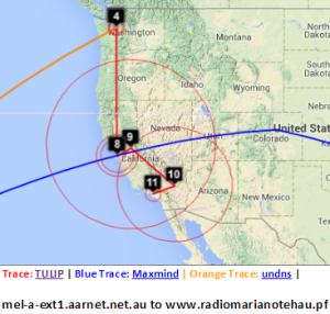
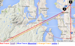
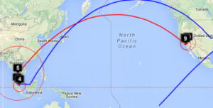
| Melbourne to French Polynesia | Detail for Australia | Detail of VTrace & undns at Melbourne | Detail of W. Coast US | Detail showing VTrace & undns at Seattle | Malaysia to French Polynesia | Japan to French Polynesia |
|---|---|---|---|---|---|---|
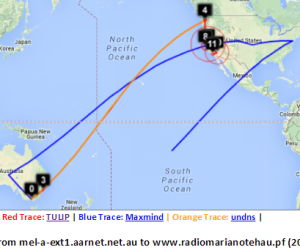
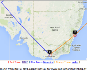
Maxmind gets the location of the host in French Polynesia. However the route in Australia and the US is badly off. Vtrace and undns agree for Australia and for hops in the US. VTrace does not work for French Polynesia since the underlying TULIP does not attempt to locate a host where the nearest Tier 0 landmark (SLAC) has > 60msec min_RTT. N.b. Australia's route to French Polynesia goes via the U.S. as does Malaysia's, and Japan's. The Japan traceoute is interesting in that undns shows the route as going via Chile. THis requires more investigation. The landmarks in China and Bolivia were unable to make traceroutes.
Miscellaneous
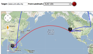
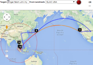
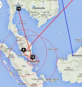
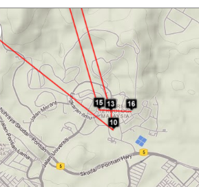
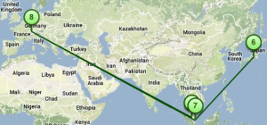
The traceroute from SLAC to UTM, Johor Bahru, Malaysia for MaxMind goes to central US, Japan, then via China and terminates in Sarawak. The VTrace goes from SLAC to Japan (undns confirms this), then to Kuala Lumpur Malaysia, then to Johor Bahru. It then takes an excursion to the Gulf of Thailand (hop 14) and appears to stop there (middle image below). On more detailed inspection (right hand image below), it is seen that it then returns to Johor Bahru and UTM (hops 15-16).
| Global view of SLAC to UTM, Johor Bahru,Malaysia | E. Asia part of route | Last few hops |
|---|---|---|
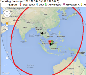
Looking in more detail at hop 14, only 4 landmarks have a minimum RTT of < 60ms. Three are in Thailand and one in Kuching Malaysia. See left image below. There are other landmarks in the area, one at UTM in Johor Bahra, Malaysia, another at UM in Kuala Lumpur. However, for unknown reasons neither UTM nor UM were able to ping 161.139.244.5.
| Landmarks with < 60msec minimum RTT to 161.139.244.5 | Geolocation of 161.139.244.5 | |
|---|---|---|
Other Visual Traceroutes
- CQ Traceoute, one server in St Paul, Minnesota, gives country, lat/long and distance of router from server, shows map as static image
- DNSTools, one server in Frankfurt, no lat/long, provides map
- WhatismyIPaddress, only takes IP addresses, tabular output identifying city, map shows end point only
- Montis, has 3 servers, in US (Pacific Northwest), Europe (Ireland) and Asia/Pacific (Singapore), provides map, no lat/longs or cities
- Visualware, can choose server region and a limited number of target regions, requires Java, does not support traceroutes
- VisualRoute, buy application, identifies city, no lat/longs. no map
- Free Visual, download free application, don't see a map
- GTrace, download free application, has map
- VTrace multiple servers, gives lat/long plus error, provides map,city, country code
Of these Montis appears to be the most reasonable to compare with.
| Montis Server in Singapore to UM Kuala Lumpur | ||
|---|---|---|

