| |
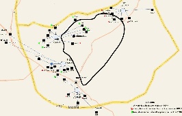
Map of PERN's connectivity to Universities in the Islamabad region. Legend for the map | Map of Islamabad area with rough guesses at locations of the PoPs. F=FJWU (chaklala 3), B= NUST, C=AIOU, D=NDC, E=QAU. The distances are: FJWU-NUST=20km, NUST-AIOU=9.3km, AIOU-QAU=17km, QAU-FJWU=30km. It is assumed the fibres roughly follow the roads. |


We calculated the lat/long of Islamabad nodes (from http://itouchmap.com/latlong.html) and calculated the distance using formula
(courtesy of http://www.meridianworlddata.com/Distance-Calculation.asp):
...