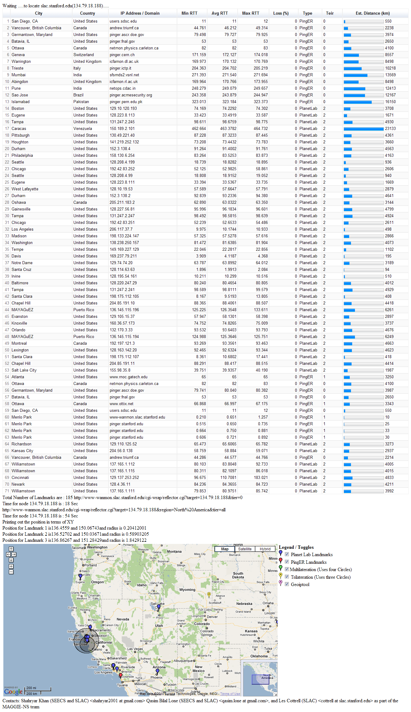
Faisal generated TULIP results for SLAC as target (134.79.18.188) and TULIP geo-located it to be in Wyoming. Screenshot here. This is obviously way off.
Dr. Les quickly explained to me what TULIP was doing and wanted to do a quick analysis of the same location (i.e. SLAC) using CBG with tri-lateration. So I found a target located at SLAC (134.79.18.134) in CBG list. We ran CBG with tri-lateration for this target. The results were way off. The error distance was of the order of ~3200 km.
However Dr. Les pointed out that we should be using three landmarks that have the minimum RTT values from the target. Thus we shuffled our values accordingly and re-ran the test with two different set of landmarks. This helped to verify our results. Table below shows the results:
Landmark 1 |
Landmark 2 |
Landmark 3 |
Error (km) |
Distance to nearest landmark (km) |
Area of Region (km) |
Est. Lat/Long |
Actual Lat/Long36.9899 -122.06 |
|---|---|---|---|---|---|---|---|
36.9899 -122.06 (Santa Cruz) |
38.4829 -121.64 (Davis) |
37.3558 -121.954 (Santa Clara) |
25.254 |
2.5132 |
1498.5 |
37.474 -121.93 |
37.418 -122.2 |
37.4285 -122.178 (Stanford) |
37.3762 -122.183 (Palo Alto) |
37.3558 -121.954 (Santa Clara) |
2.5156 |
2.5132 |
1048.8 |
37.429 -122.18 |
37.418 -122.2 |
Other results are also encouraging, so far I've analyzed around 20 targets, comparing multi-lateration and tri-lateration results. CBG with tri-lateration seems to be performing well.
These results prove that tri-lateration works. So the question is why is TULIP failing so miserably?
Spreadsheet here shows a comparison of error (in km) between CBG with multi-lateration and CBG with tri-lateration. The technique I've followed:
What I didn't do so far and why:
What I've tried and didn't work:
In the spreadsheet we have made various calculations in order to understand the results.
1. Amount of NaNs in error for multi-lateration and tri-lateration
67/171 for multi-lateration and 6/171 for tri-lateration.
NaN (Not a Number) is a value of numeric data-type representing an undefined or unrepresentable value, especially in floating point calculations. \[Reference and more here\|[http://en.wikipedia.org/wiki/NaN|http://en.wikipedia.org/wiki/NaN]\]. |
According to the CBG code NaNs represent "bad pairs that lead to no region". This means that landmarks that fail to produce intersection regions, consequently also fail to produce an estimate for the location of the target and instead giving out an erroneous value. Author has handled such values with NaN (code snippet below).
      if constraintType
        warning('Trying speed of light')
        constraintType = 0;
        % switch the constraint type and try again
        \[locest,actual,error,regarea,distNearestLandmark,target_id,constraintType,inRegion\] = geolocate(file,extension,hullbool, constraintType, bestlineTable);
        return;
      else
        % find the badPairs that lead to no region, write them to stdout
        badPairs = analyzeNoRegion( measurements )
        %error(\['No SOL intersection region for ', char(file)\])
        region = \[NaN NaN\];
        locest = \[NaN NaN\];
        error = NaN;
        regarea = NaN;
        results = \[target_id error; distNearestLandmark regarea; locest; actual; region\];
        dlmwrite(\[char(file),char(extension)\],results,' ');
        return;
      end;
if constraintType
  warning('Trying speed of light')
  constraintType = 0;
  % switch the constraint type and try again
  \[locest,actual,error,regarea,distNearestLandmark,target_id,constraintType,inRegion\] = geolocate(file,extension,hullbool, constraintType, bestlineTable);
  return;
else
  % find the badPairs that lead to no region, write them to stdout
  badPairs = analyzeNoRegion( measurements )
  %error(\['No SOL intersection region for ', char(file)\])
  region = \[NaN NaN\];
  locest = \[NaN NaN\];
  error = NaN;
  regarea = NaN;
  results = \[target_id error; distNearestLandmark regarea; locest; actual; region\];
  dlmwrite(\[char(file),char(extension)\],results,' ');
  return;
end;
|