...
N. America
A similar chart (tier1-na.pngthe spread sheet can be found here) is shown below for a landmark in Chicago making ping RTT measurements to hosts with known locations around the world. 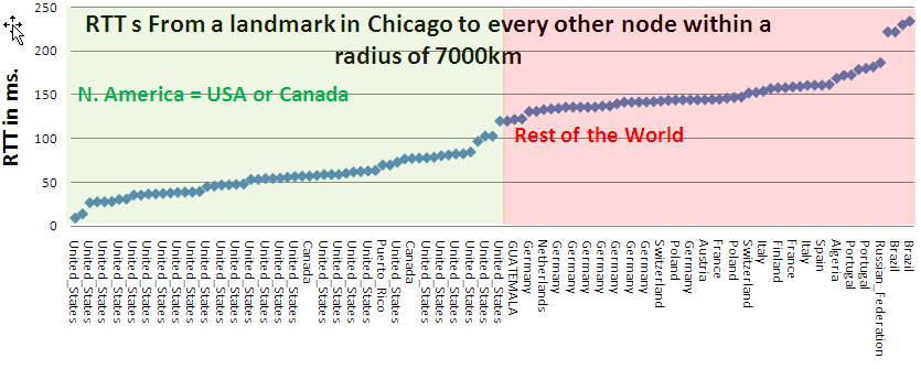
This time the gap is not so clear, however there is a definite gap such that targets within 120ms are in N.America and those >120ms are elswehere. The North America target at 119ms is in Vancouver Canada. The route goes via Chicago, Kansas City, Boise, Denver, Hanford (Washington). Then it goes through 207.231.240.21 to Vancouver, Canada. According to Geotool 207.231.240.21 is in Los Angeles. However data based location methods are typically poor for routers so the confidence in this is poor. At the same time 207.231.240.21 does not respond to pings so we are unsure of its location. At the cost of increasing the tier1 regional estimation traffic, it is possible we could have a clearer separation using more tier1 landmarks in N. America. This may deserve more exploration