...
| Panel |
|---|
Location: in the form City_Country_Type (the only Type currently is PL=PlanetLab) |
Deployment of Landmarks
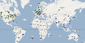
You can see a Google map of the PlanetLab and SLAC/Looking Glass landmarks by clicking below or by going to: http://www.slac.stanford.edu/comp/net/wan-mon/viper/tulip_googlemap.htm
Tiering
To reduce the network impact and reduce the initial rough estimate time, we also break the landmarks into two tiers. Tier0 landmarks are used to identify the region for the target. Then tier1 hosts for that region can be used to more exactly locate the target. Tier0 hosts are chosen as being at the edges of the region, being well connected, highly reliable and quick to respond. We currently only define tier0 hosts for North America and Europe. In other regions all the landmarks are regarded as tier0. There are about 8 tier0 hosts for North America and 4 for Europe. This reduces the number of landmarks to make measurements from with a tier0 request since there are over 100 landmarks in either North America or Europe.
...