...
Maps of the cables and the affected countries can be found at SEAMEWE3 and SEAMEWE4. A Telegeography map of the cable routes in the Mediterranean is seen below and there is a report of progress on January 22nd:
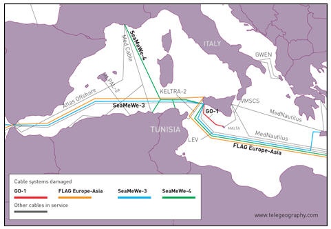
The telegeogrpahy
Losses
The measured effects on the losses seen from N. America (SLAC in California) to hosts in N. Africa (Egypt, Sudan); Middle East (Bahrein, Palestine, UAE, Oman, Jordan, Lebanon, Saudia Arabia); S. Asia (Sri Lanka, Maldives, Pakistan) are huge. As seen from PingER daily loss data measured from SLAC, comparing the losses on Friday Dec 19 with those on Mon-Thu (15-18 Dec) the losses have increased by a factor of 5 to 30 times for most of the hosts monitored in the above countries.
...