Introduction
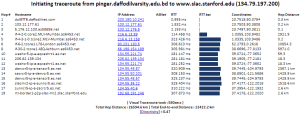
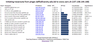
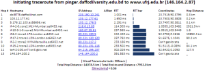
Visual Traceroute is a new feature that can be accessed by calling reflector.cgi with function=vtrace. Currently it can provide visual traceroute from 29 landmarks (2 in USA and 1 per each of 27 countries). Some of these are listed below, for a complete list check the from dropdown:
...
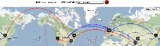
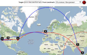
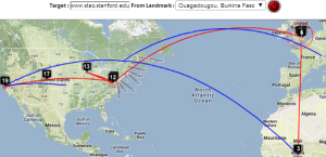
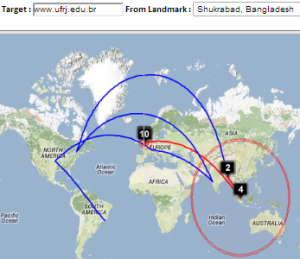
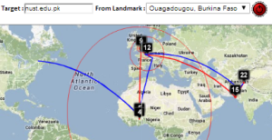
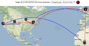
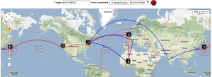
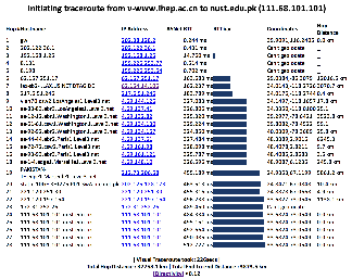
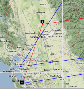
| Beijing to NUST | Bangladesh to SLAC | Bangladesh to CERN | Bangladesh to Rio de Janeiro | Burkina Faso to NUST | Burkina Faso to SLAC | Burkina Faso to KEK Tokyo |
|---|---|---|---|---|---|---|
 |  |  |  |  |  |  |
 |  |  |  | 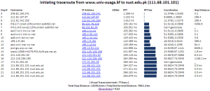 |  |  |
| Taiwan to NUST | |||
|---|---|---|---|
 | |||
|
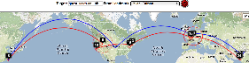
Complementarity of VTrace and MaxMind
| SLAC to Braga Spain overview | SLAC to Braga, W. Coast US | SLAC to Braga via Netherlands and UK | SLAC to Braga, Portugal detail | Traceroute | TULIP geolocation of Braga |
|---|---|---|---|---|---|
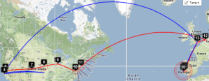 |  | 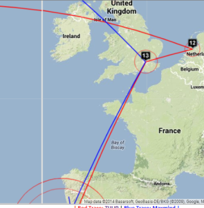 | 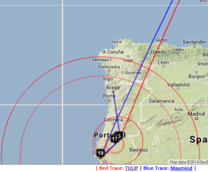 | 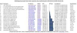 | 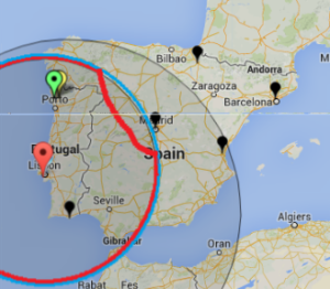 |
By providing both VTrace (red) and Maxmind (blue) routes, the results can be complementary in ascertaining the correct route. This is illustrated in the plots below from SLAC to a host in Braga Portugal (193.136.19.13). The left hand map shows how VTrace accurately traces the route across the US, while Maxmind jumps from SLAC to the middle of the US, back to Berkeley and thence to Europe. This is shown in more detail in the W. Coast US map. Moving futheright, Vtrace shows the route through the Netherlands and the UK, while Maxmind misses the Netherlands altogether. The Portugal detail indicates that Maxmind is more accurate in showing the final route to Braga. However, note that the Vtrace accuracy circles indicate the considerable uncertainty in the location of the last hop, hence improving ones confidence. The traceroute figure which indicates that hops 12 and 13 are likely to be in the Netherlands and the UK given their naming conventions (note the top level domains .nl and .uk in the names). The TULIP plot shows how the paucity of nearby landmarks (black market balloons) results in the poor geolocation of the Braga site.
Other Visual Traceroutes
- CQ Traceoute, one server in St Paul, Minnesota, gives country, lat/long and distance of router from server, shows map as static image
- DNSTools, one server in Frankfurt, no lat/long, provides map
- WhatismyIPaddress, only takes IP addresses, tabular output identifying city, map shows end point only
- Montis, has 3 servers, in US (Pacific Northwest), Europe (Ireland) and Asia/Pacific (Singapore), provides map, no lat/longs or cities
- Visualware, can choose server region and a limited number of target regions, requires Java, does not support traceroutes
- VisualRoute, buy application, identifies city, no lat/longs. no map
- Free Visual, download free application, don't see a map
- GTrace, download free application, has map
- VTrace multiple servers, gives lat/long plus error, provides map,city, country code
...