...
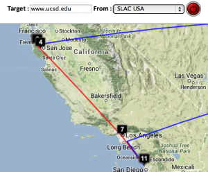
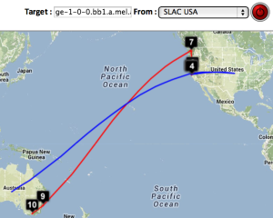
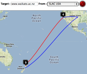
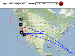
Two traceroute paths are shown on the google map. One (shown in red) is drawn using TULIP and the other (shown in blue) is drawn using MaxMind (an IP host location database). The hops are shown as appropriate numbered markers, the error in the estimated location is shown as a red circle. See the figure below:

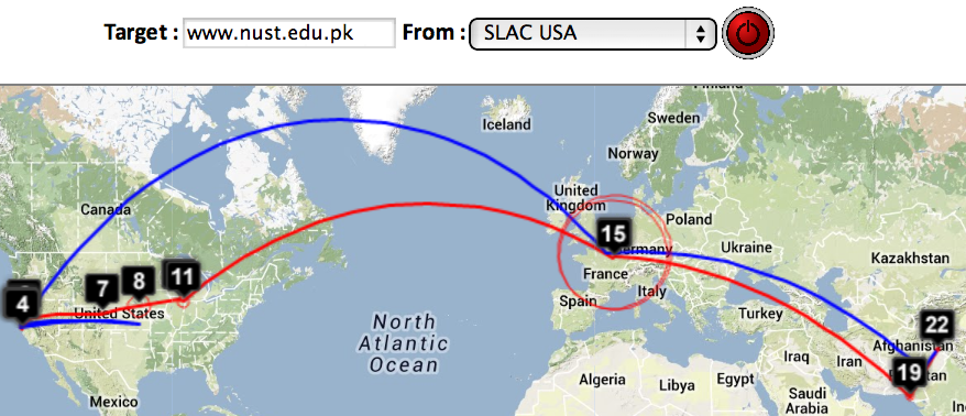
This figure shows the traceroute from SLAC to NUST Pakistan. http://www-wanmon.slac.stanford.edu/cgi-wrap/reflector.cgi?function=vtrace&target=nust.edu.pk
...
| SLAC to CERN | SLAC to ICTP Trieste | SLAC to NUST | SLAC to UCSD | SLAC to Melbourne | SLAC to Waikato New Zealand | SLAC to U Oregon |
|---|---|---|---|---|---|---|
 |  |   |  |  |  |  |